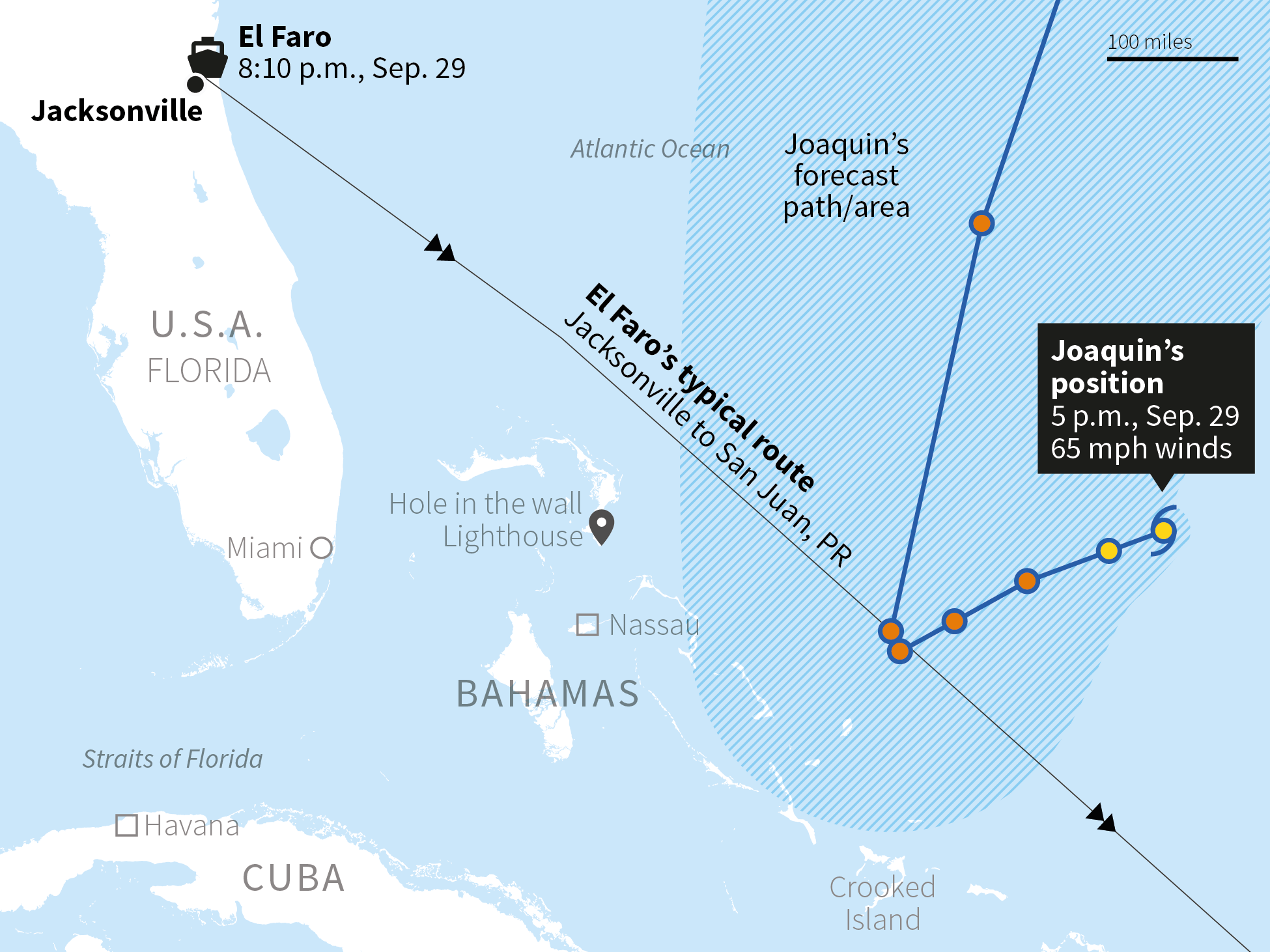
Sep. 29, 8:10 p.m.: Left Jacksonville Port. Three hours before El Faro departed, the National Hurricane Center's 5 p.m. advisory expected Joaquin to become a hurricane within 24 hours.
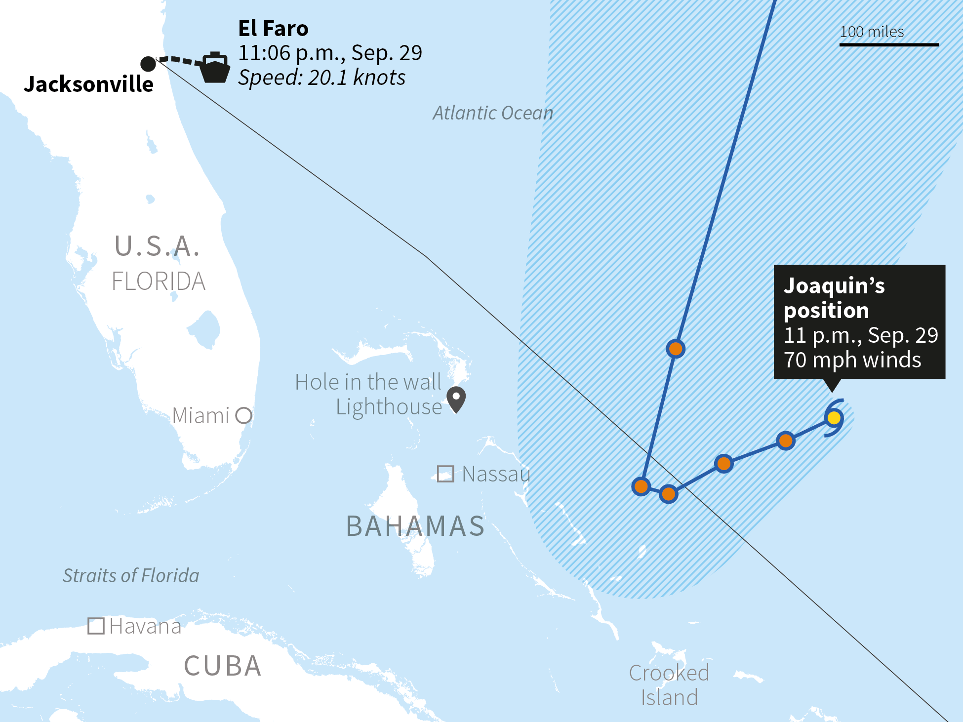
Sep. 29, 11:06 p.m.: Three hours after El Faro departed, the NHC's 11 p.m. advisory said that Joaquin is expected to become a hurricane in the next 12 hours.
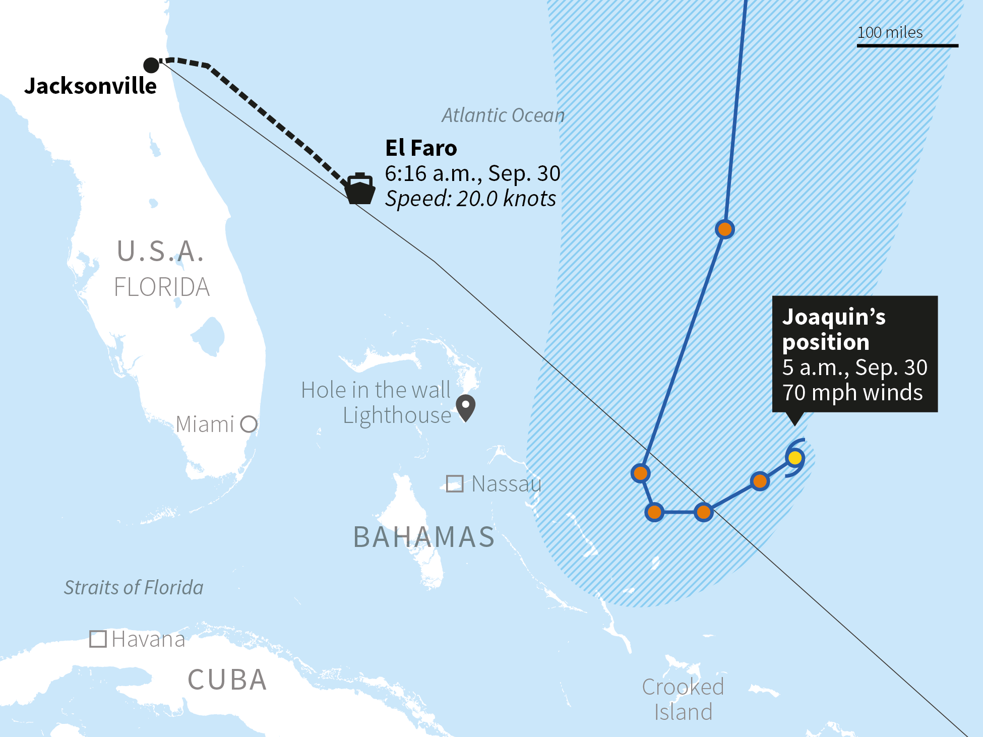
Sep. 30, 6:16 a.m.: Begins to veer slightly south from usual course. Travelling at 20.0 knots, near its top speed.
Sep. 30, 2:13 p.m.: Passing northern Bahamas, about 25 miles south of its usual course at 19.9 knots.
Sep. 30, 9:09 p.m.: El Faro continues to veer south west from normal course, now very close to the Bahamas.
Oct. 1, 2:09 a.m.: Slowing to 16.9 knots, the ship is about 90 miles south of its usual course. El Faro is now in the direct path of the storm.
Oct. 1, 3:56 a.m.: Last known location logged. The ship is believed to have sunk after being caught in Joaquin's ferocious winds and high seas.
Alternate route: In August, El Faro used another route which would have avoided Joaquin's path. It is unclear why the ship did not take the other route this time.


Sustained wind speed
Note: All times Eastern Daylight time.
Sources: Thomson Reuters; NOAA
By Christine Chan, Travis Hartman, and Edward McAllister